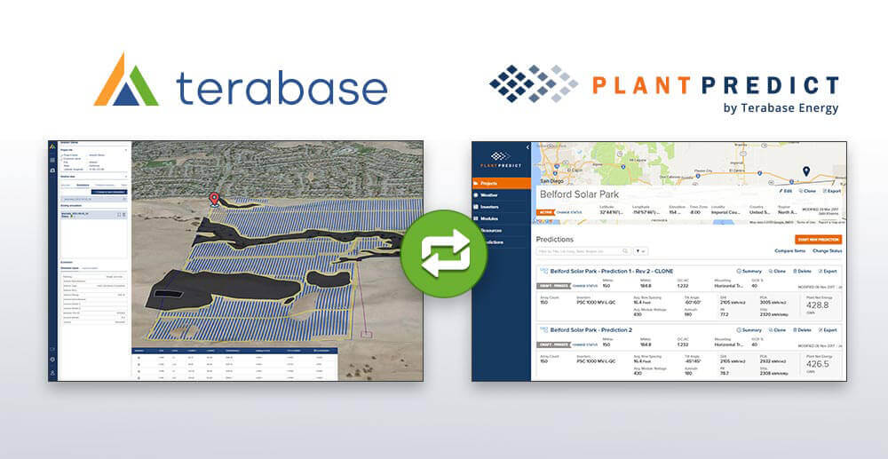
On March 29, 2022, Terabase hosted a webinar showcasing the brand new integration between the Terabase Development Platform and PlantPredict (recently acquired by Terabase from First Solar).
Watch the full recording below or on YouTube.
Topics covered include:
- Linking Terabase & PlantPredict accounts.
- Sharing projects across the two apps.
- Using PlantPredict for in-depth reporting.
- Understanding how losses affect predictions in PlantPredict.
- Uploading custom module, inverter, and weather files.
WEBINAR Q&A – GENERAL QUESTIONS
Q) What should be the ideal flow for any new project? Terabase analysis first and then PlantPredict? Or vice versa?
A) We do not dictate a process on our customers, and we consider our flexibility to be a point of strength for our tools. We allow our customers to wrap their process around our tools, so each customer can decide the ideal way to use PlantPredict and Terabase. In fact, we don’t even require that our users use both tools if they choose not to. Both software can be used independently.
Q) I often see a “race to the bottom” where the lowest GCR tends to always lead to the lowest LCOE. That seems to have happened during the demo, right? What drives that? Land cost?
A) This question highlights the default assumptions on costs and financial input parameters on the platform. Key inputs for fixed costs, such as development fees and land costs, are typically major drivers for pushing the lowest LCOE solution towards higher GCRs. We encourage our users to take advantage of the customer EPC cost inputs, which includes fields for $/Wdc and fixed $, and evaluate the impact on financial results.
Q) How is data privacy managed?
A) Please refer to our Privacy Policy located here: https://www.terabase.energy/legal/privacy-policy
WEBINAR Q&A – TERABASE DEVELOPMENT PLATFORM QUESTIONS
Q) Does the Terabase development platform EPC cost tool assumptions have sensitivities to changes in commodity pricing or increases in shipping costs?
A) The EPC cost has a database of material are updated regularly. These updates take into account changes in commodity pricing, however with the rapid fluctuations Users have the ability to update major EPC costs such as module, racking, and cabling pricing in the EPC Cost menu before running a simulation.
Q) Can the estimation data resource customized based on our own resources?
A) Yes, many of the main EPC cost drivers can be manually updated in the EPC Cost menu before running a simulation. These cost drivers include module, racking, and cabling pricing.
Q) Is there an ability to see the detail of DC BOS design?
A) The DC BOS routing is uniquely generated for each layout based on Terabase’s standard assumptions on DC cable routing. A visualization can not currently be viewed at this time, however a detailed report of all DC components can be viewed in the downloadable BOQ.

Q) Can you discuss the GIS features a little more? Is it possible to search for parcels with a specified amount of developable land within a mile of a 138kv or greater substation?
A) The Terabase Development Platform has a variety of GIS layers that can be added to the map in order to assist in the development process. Among many others these layers include parcel, topography, and existing electrical grid infrastructure maps. Each layer has metadata that can be viewed by clicking on a loaded layer on a specific point on the map. For substations this metadata includes the substation size, so the size of any substation can be found by clicking on it when the layer is loaded in the map. Parcels surrounding the substation can then be found by loading the parcel layer.
Q) Can you export the Terabase layout as other formats, such as PDF?
A) The Terabase Development Platform layouts can be exported in KML format. At this time the layouts can not be exported in PDF form. It is common for users to take a screen shot of the layout and include it in PDF reports.
Q) Is it possible to export Terabase layout as DXF format?
A) While it is not possible to download the Terabase Development Platform layout as a DXF at this time, the layout’s can be downloaded in KML format.
Q) Is there a way to exclude partial arrays in the Terabase platform layout like you can in the PlantPredict Mapbuilder tool?
A) The Terabase platform uses a different method for constructing AC Arrays, which eliminates the concept of partial arrays like what we see in PlantPredict.
Q) Does the Terabase Development Platform support the API automation for batch processing like PlantPredict does?
A) The Terabase Development Platform does not currently support API automation for batch processing. The Platform is built on the cloud using many internal APIs. These APIs are available for use to enterprise customers, please contact us if you are interested in a customer integration of our Platform and your tools.
WEBINAR Q&A – PLANTPREDICT QUESTIONS
Q) How much does PlantPredict Premium Cost?
A) Please refer to our PlantPredict Premium Page to get a breakdown of our license costs: https://plantpredict.com/plantpredict-premium/
Q) What parameters can we change when we are optimizing a design?
A) While you can vary any parameter when doing an optimization, the most common parameters are Ground Coverage Ratio (GCR), DC/AC Ratio, EPC cost, and financial inputs. Others include product selection from PlantPredict’s module and inverter libraries, as well as the ability to add you own equipment.
Q) Can a PlantPredict User utilize the API to do Optimization?
A) Yes, optimization is one of the many things that a user can do with the PlantPredict API. If you want to script out a proprietary optimization method and/or incorporate a proprietary cost/financial model, then the API is the way to go.
Q) Does PlantPredict model Bifacial Modules?
A) Yes, PlantPredict has modeled Bifacial Modules for several years now, and has been proven to be very accurate at modeling Bifacial. One such study was conducted by the Technical University of Denmark. If you would like to learn more, you can watch the following webinar about that study: https://youtu.be/C0FWw5tn7ng
Q) What integrations does PlantPredict have “off the shelf”?
A) With PlantPredict Premium, you can use the 1-click weather download to import unlimited location specific weather files from Meteonorm, NSRDB and NASA. Users can also download a limited number of Weather Files from CleanPowerResearch (a.k.a. Solar Anywhere), SolarGIS and SolCast. Unlimited plans can be purchased directly from these vendors. Regarding Map Overlays, USFWS Wetland and FEMA Flood Plain data is available to all PlantPredict Users, but with PlantPredict Premium you also get Parcel Data, Transmission Line, Substation and some pipeline data as well.
Q) How can we request a Free Trial of PlantPredict Premium?
A) After you have registered for a PlantPredict account, send an email to support@plantpredict.com and request a Free Trial license to PlantPredict Premium and we will set you up.
Q) Can the layout design be downloaded as a standard engineering report?
A) The PlantPredicy layout can be downloaded in a standard engineering report format called the PLP1000. From the Terabase Development Platform the layout can be downloaded in KML format, along with a detailed BOQ, EPC Cost, and Financial reports.
Q) How many Energy Predictions can run simultaneously in PlantPredict?
A) Our default configuration can run 4 predictions simultaneously. We do have auto-scaling servers, so when our servers detect a backup in our queue, they will ramp up additional servers after a few minutes of sensing that there is a backlog.
Q) Does PlantPredict have the ability to model Tree Shading?
A) Yes, PlantPredict has support for Object Shading beginning with Version 8 (released in 2020). You must setup the objects that will be casting the shadow in the DC Fields, and this only works with Block Builder Predictions.
Q) How do you configure albedo in PlantPredict?
A) Albedo can be configured on a monthly basis. PlantPredict Premium users are able to automatically pull in location specific Albedo values from the NSRDB albedo database.
Q) Does PlantPredict have detailed shading analysis?
A) Yes, PlantPredict has very sophisticated shading analysis capabilities. You can utilize a 2D shading model, which returns results very quickly and is fairly accurate even when modeling sloped terrain. You can also utilize a 3D shading model, that can model object shading along with a more detailed electrical shading model for row-to-row shading. The biggest drawback to using the 3D shading model is that it drastically increases the time that it takes to run a prediction.
Q) Can I control the energy loss assumptions that PlantPredict uses when running a Scenario in Terabase?
A) Yes, there is a Losses section in the Terabase Simulation parameters that has soiling losses, DC and AC Loss parameters that can be input into the Terabase Simulation and will be carried into PlantPredict for use when calculating the energy prediction.
Q) Can I make changes to an energy prediction in PlantPredict, for a prediction that was generated by the Terabase platform, and sync the results back into the Terabase Scenario results?
A) Unfortunately, not at this time. In the future, we may offer the ability to sync energy prediction results back to a Terabase scenario so that you can re-run the financial results, but that is not possible with the current integration.
Q) How can we see the model/equations being used to predict the performance?
A) The PlantPredict Models and Algorithms are provided and documented on the PlantPredict website. Feel free to review this documentation here: https://plantpredict.com/algorithm/introduction/
Q) In Plant Predict, does the energy prediction take into account the topography from the 3D view?
A) PlantPredict currently takes into account the prevailing grade of your site, if you turn on the Advanced Slope Analysis mode in the Map Builder tool. We have plans to improve this over the course of 2022 to beter model undulations and other topographical challenges that our users face.
Q) Does your terrain and metadata cover Canada at all?
A) The terrain metadata is available in Canada, as well as all other countries in the world.